 |
 © ©
|  |
 |
| Vessel Type: | Liner | Location: | Co. Donegal |
| Date of Loss: | 3rd November 1940 | Place: | Bloody Foreland |
| Cause of Loss: | Torpedoed | Boat Dive from: | Magheroarty |
| Charted Depth: | 50m | Irish O.S. Map: | Discovery Series No. 1 |
| Height of Wreck: | 15m | Admiralty Chart No: | 2752 and/or 1883 |
| Hull Material: | Steel | Latitude (approx.): | 55° 18' 08" North |
| Type of Seabed: | Rocky | Longitude (approx.): | 07° 35' 16" West |
| Average Visibility: | 20m | Convert Lat. & Long. to - | Decimal - CLICK HERE |
| Image available? | Yes - see below | Diving Experience: | Very Experienced |
| Diving Information: |
|
| Historical Information: |
|
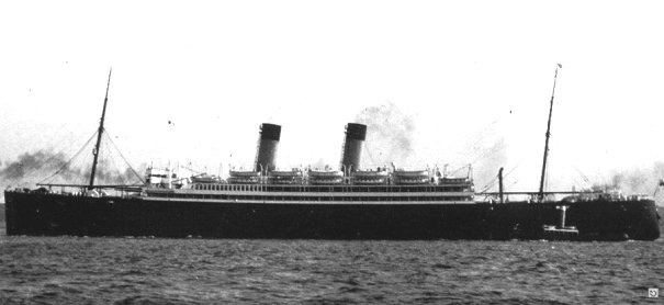
© by kind permission of lostliners web site
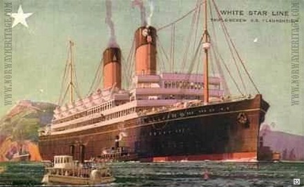
© by kind permission of Børge Solem and Trond Austheim of norway heritage web site
| Source Publications: |
| "Dictionary
of Disasters at Sea during the Age of Steam 1824 - 1962" |
by | Charles Hocking |
| London Stamp Exchange 1989 - ISBN: 0948130474 | ||
| "Great
Passenger Ships of the World" |
by | Arnold Kludas |
| "Shipwreck
Index of Ireland" |
by | Richard & Bridget Larn |
| Lloyd's Register - Fairplay Ltd 2002 - ISBN: 1900839970 | ||
| "Shipwrecks
of the Irish Coast 932 - 1997" |
by | Dr. Edward J. Bourke |
| Edward J. Bourke 1998 - ISBN: 0952302713 |
| Other Sources: |
| Rob
Betz | - | www.lostliners.com (2002) |
|
|
Last update - 08-May-2003
|
|
A page from "www.irishwrecksonline.net" ©