 |
 © ©
|  |
 |
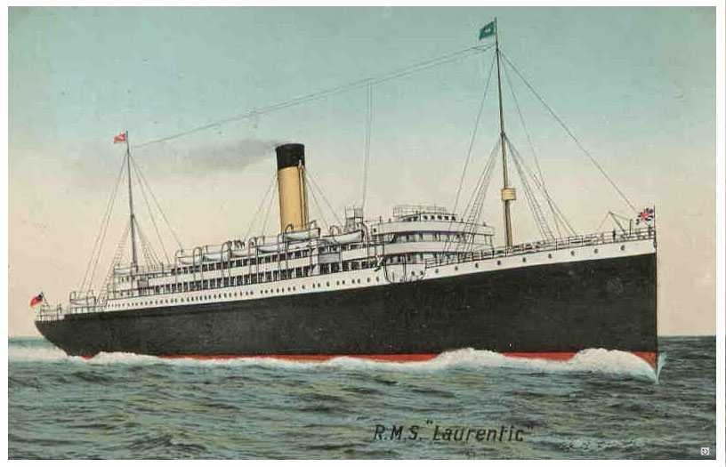
| Vessel Type: | Liner | Location: | Co. Donegal |
| Date of Loss: | 23rd January 1917 | Place: | Mouth of Lough Swilly |
| Cause of Loss: | Mined | Boat Dive from: | Port Salon |
| Charted Depth: | 41.8m | Irish O.S. Map: | Discovery Series No. 2 & 3 |
| Height of Wreck: | Scattered | Admiralty Chart No: | 2697 and/or 2811 |
| Hull Material: | Steel | Latitude (GPS): | 55° 18' 14.52" North |
| Type of Seabed: | Stones and shale | Longitude (GPS): | 07° 35' 27.84" West |
| Average Visibility: | 15 - 20m | Convert Lat. & Long. to - | Decimal - CLICK HERE |
| Image available? | Yes - see below | Diving Experience: | Experienced |
| Diving Information: |
|
| Historical Information: |
|
All external copyrights respectfull acknowledged
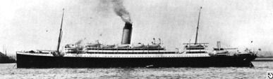
© by kind permission of lostliners web site
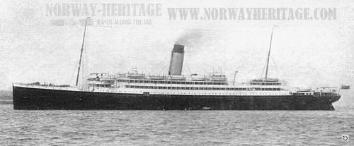
© by kind permission of Børge Solem and Trond Austheim of norway heritage web site
Click
HERE
for INFOMAR* Side-Scan image |
Source
Publications:
|
| "Dictionary
of Disasters at Sea during the Age of Steam 1824 - 1962" |
by | Charles Hocking |
| London Stamp Exchange 1989 - ISBN: 0948130474 | ||
| "Dive"
Magazine article |
by | Rich Stevenson (March 2001) |
|
"Donegal,
An Exploration" |
by | J.J. Tohill |
| Donegal Democrat Ltd 1976 | ||
"Great
Passenger Ships of the World" | by | Arnold Kludas |
| "Scuba"
Magazine article | by | Darren McDonagh (November 2016) |
|
"Shipwreck
Index of Ireland" |
by | Richard & Bridget Larn |
| Lloyd's Register - Fairplay Ltd 2002 - ISBN: 1900839970 | ||
| "Shipwrecks
of the Irish Coast 932 - 1997" |
by | Dr. Edward J. Bourke |
| Edward J. Bourke 1998 - ISBN: 0952302713 | ||
|
"Shipwrecks
of the Irish Coast 1105 – 1993" |
by | Dr. Edward J. Bourke |
| Edward J. Bourke 1994 - ISBN: 0952302705 | ||
| "Shipwrecks
of the Irish Coast 1582 - 2000" |
by | Dr. Edward J. Bourke |
| Edward J. Bourke 2000 - ISBN: 0952302721 |
Other
Sources: |
*source
- Geological Survey of Ireland | - | Internet (2020) |
| Rob
Betz | - | www.lostliners.com (2002) |
| Vic
Foster |
- | Castlereagh SAC (1996) |
| Royal
Navy |
- | Hydrographic Department (1970) |
| |
Last update - 13-Nov-2020
|
|
A page from "www.irishwrecksonline.net" ©