|
|
 © ©
|  |

 |
| Vessel Type: | Three Masted Barque | Location: | Co. Wexford |
| Date of Loss: | 22nd February 1917 | Place: | Coningbeg Rock |
| Cause of Loss: | Torpedoed | Boat Dive from: | Kilmore Quay |
| Charted Depth: | 45m | Irish O.S. Map: | Discovery Series No. 77 |
| Height of Wreck: | 2m | Admiralty Chart No: | 2740 and/or 1410 |
| Hull Material: | Steel | Latitude (GPS): | 52° 04' 09" North |
| Type of Seabed: | Rocks & gravel | Longitude (GPS): | 06° 38' 28.8" West |
| Average Visibility: | 10 - 15m | Convert Lat. & Long. to - | Decimal - CLICK HERE |
| Image available? | Yes - see below | Diving Experience: | Experienced |
| Diving Information: |
|
| Historical Information: |
|
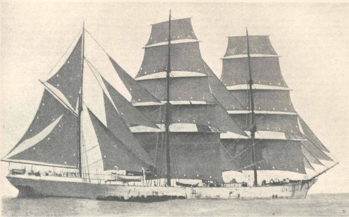
Photographer unknown
All rights respectfully acknowleged
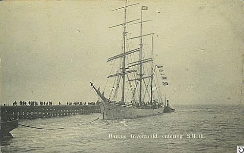
© by kind permission of wrecksite.eu web site
| Source Publications: |
| "Shipwreck
Index of Ireland" |
by | Richard & Bridget Larn |
| Lloyd's Register - Fairplay Ltd 2002 - ISBN: 1900839970 | ||
| "Shipwrecks
of the Irish Coast 932- 1997" |
by | Dr. Edward J. Bourke |
| Edward J. Bourke 1998 - ISBN: 0952302713 | ||
| "Shipwrecks
of the Irish Coast 1105 – 1993" |
by | Dr. Edward J. Bourke |
| Edward J. Bourke 1994 - ISBN: 0952302705 | ||
|
"Shipwrecks
of the Irish Coast 1582 - 2000" |
by | Dr. Edward J. Bourke |
| Edward J. Bourke 2000 - ISBN: 0952302721 | ||
| "Underwater
Ireland Guide to Irish Dive Sites" |
by | Irish Underwater Council |
| CFT 1999 - ISBN: 0948283025 |
|
|
Last update - 02-Feb-2014
|
|
A page from "www.irishwrecksonline.net" ©