 |
 © ©
|  |
 |
| Vessel Type: | Admiralty Trawler | Location: | Co. Donegal |
| Date of Loss: | 23rd June 1917 | Place: | Malin Head |
| Cause of Loss: | Mined | Boat Dive from: | Bunagee Pier in Culdaff, or at Glengad Pier |
| Charted Depth: | 33m | Irish O.S. Map: | Discovery Series No. 3 |
| Height of Wreck: | 3m | Admiralty Chart No: | 2811 |
| Hull Material: | Steel | Latitude (approx.): | 55° 22' 12" North* |
| Type of Seabed: | Course shell gravel | Longitude (approx.): | 07° 10' 12" West* |
| Average Visibility: | 10 - 15m | Convert Lat. & Long. to - | Decimal - CLICK HERE |
| Image available? | Yes - see below | Diving Experience: | Experienced |
| Diving Information: |
|
| Historical Information: |
|
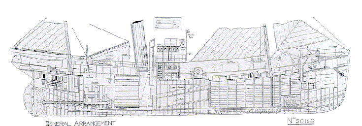
© by kind permission of Tim Mackie
Click
HERE
for INFOMAR* Side-Scan image |
Source Publications: |
| "Shipwreck
Index of Ireland" |
by | Richard & Bridget Larn |
| Lloyd's Register - Fairplay Ltd 2002 - ISBN: 1900839970 | ||
| "Shipwrecks
of the Irish Coast 932 - 1997" |
by | Dr. Edward J. Bourke |
| Edward J. Bourke 1998 - ISBN: 0952302713 |
Other
Sources: |
*source
- Geological Survey of Ireland | - | Internet (2020) |
| Tim
Mackie | - | Queens University of Belfast SAC (2000) |
| |
Last update - 16-Nov-2020
|
|
A page from "www.irishwrecksonline.net" ©