 |
 © ©
|  |
 |
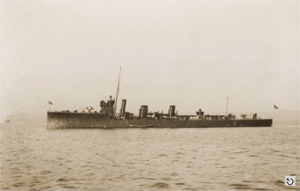
| Vessel Type: | Destroyer | Location: | Co. Antrim |
| Date of Loss: | 2nd October 1917 | Place: | Rathlin Island |
| Cause of Loss: | Torpedoed | Boat Dive from: | Ballycastle |
| Charted Depth: | 42m | Irish O.S. Map: | Discovery Series No. 5 |
| Height of Wreck: | 4m | Admiralty Chart No: | 2798 |
| Hull Material: | Steel | Latitude (approx.): | 55° 17' North |
| Type of Seabed: | Longitude (approx.): | 06° 16' West | |
| Average Visibility: | Convert Lat. & Long. to - | Decimal - CLICK HERE | |
| Image available? | Yes - see below | Diving Experience: | Very Experienced |
| Diving Information: |
|
| Historical Information: |
|
via Michael Montgomery (Castlereagh SAC)
All external copyrights respectfully acknowledged
| Source Publications: |
by | Roy Stokes & Liam Dowling | |
|
"Shipwreck
Index of Ireland" |
by | Richard & Bridget Larn |
| Lloyd's Register - Fairplay Ltd 2002 - ISBN: 1900839970 | ||
|
"Shipwrecks
of the Irish Coast 932 - 1997" |
by | Dr. Edward J. Bourke |
| Edward J. Bourke 1998 - ISBN: 0952302713 | ||
|
"The
Fighting Ships in the Royal Navy" |
by | E.H.H. Archibald |
| Blandford Press 1984 - ISBN: 0713713488 | ||
|
"The
Harsh Winds of Rathlin" |
by | Tommy Cecil |
| Impact Printing 1990 - ISBN: 0948154659 |
| Other Sources : |
| |
- | Internet (2021) | |
| |
Last update - 16-Feb-2021
|
|
A page from "www.irishwrecksonline.net" ©