 |
 © ©
|  |
 |
| Vessel Type: |
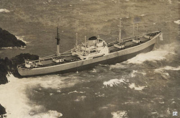
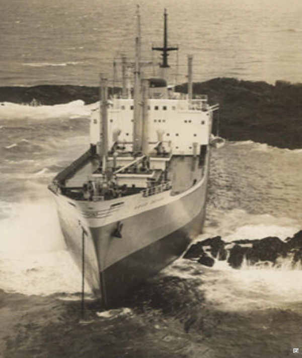
Greek Motor Vessel | Location: | Co. Donegal |
| Date of Loss: | 2nd November 1960 | Place: | Tor Beg |
| Cause of Loss: | Ran aground | Boat Dive from: | Culdaff |
| Charted Depth: | 47m | Irish O.S. Map: | Discovery Series No. 3 |
| Height of Wreck: | 14m | Admiralty Chart No: | 2723 and/or 2811 |
| Hull Material: | Steel | Latitude (approx.): | 55° 23' 24" North* |
| Type of Seabed: | Gravel | Longitude (approx.): | 07° 04' 12" West* |
| Average Visibility: | 15m+ | Convert Lat. & Long. to - | Decimal - CLICK HERE |
| Image available? | Yes - see below | Diving Experience: | Experienced. |
| Diving Information: |
|
| Historical Information: |
|
|
All external copyrights respectfully acknowledged
via David Stewart All external copyrights respectfully acknowledged
| ||||
Source
Publications: |
|
"Donegal
Shipwrecks" |
by | Ian Wilson |
| Impact Printing 1998 - ISBN: 094815456X | ||
|
"Shipwreck
Index of Ireland" |
by | Richard & Bridget Larn |
| Lloyd's Register - Fairplay Ltd 2002 - ISBN: 1900839970 | ||
| "Shipwrecks
of the Irish Coast 1105 - 1993" |
by | Dr. Edward J. Bourke |
| Edward J. Bourke 1994 - ISBN: 0952302705 |
Other Sources: |
*source
- Geological Survey of Ireland | - | Internet (2020) |
| David
Stewart | - | via email (2011) |
| Norman
Woods | - | Portstewart SAC (2000) |
| Royal
Navy | - | Hydrographic Department (1970) |
| |
Last update - 12-Nov-2020
|
|
A page from "www.irishwrecksonline.net" ©