©
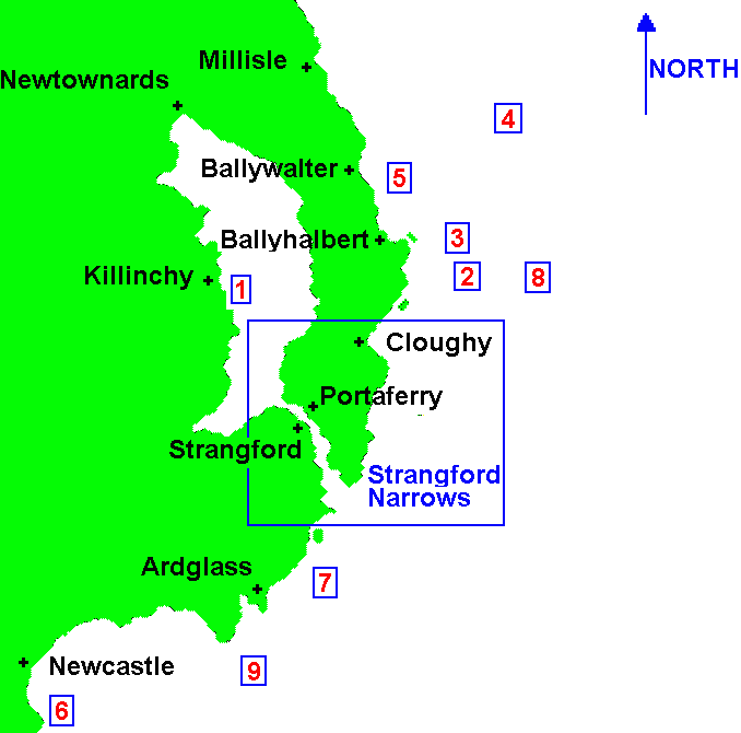
Click on Lists below or Number on map
Dived Wrecks
1/ M.Y. Alastor
2/ S.S. Amber
3/ S.S. Upas
4/ S.S. Neotsfield
5/ S.V. Loch Sunart
6/ S.S. Beechgrove
7/ S.S. Kilbroney
8/ S.S. Harold
9/ S.S. Saint Barchan
County Down Wreck Lists
South Co. Down (A)
South Co. Down (B)
South Co. Down (C)
Road Map of Ireland
Click insert for wrecks in that area
Last update -
18-May-2005
Grid Map C7
 ©
©
 ©
©