Back to Main Index Map
©
Back to Main Index Map


Click on Name below or on Number on map


Click insert for wrecks around

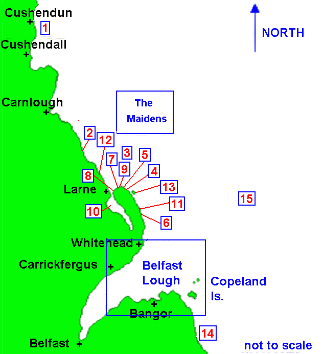
The Maidens & Belfast Lough

Last update - 17-May-2005

Grid Map B7
Belfast LoughThe MaidensS.Y. Clemintine  Lat:55^ 07' 47"N  Long:06^ 02' 15"WS.S. Thrush  Lat:54^ 58' 15"N  Long:05^ 56' 30"WS.S. State of Louisiana  Lat:54^ 52' 54.66"N  Long:05^ 45' 07.08"WS.S. Ailsa  Lat:54^ 51' 12.24"N  Long:05^ 44' 18.12"WS.V. Berbice  Lat:54^ 51' 13.26"N  Long:05^ 46' 11.22"WS.S. Black Diamond  Lat@54^ 47' 15.12"N  Long:05^ 41' 18.90"WS.V. George  Lat:54^ 51' 03.12"N  Long:05^ 47' 21.30"WS.S. Harrington  Lat:54^ 51' 07.44"N  Long:05^ 47' 21.30"WS.S. Peridot  Lat:54^ 51' 36.48"N  Long:05^ 45' 41.46"WS.V. Teanua  Lat:54^ 49' 41.46"N  Long:05^ 45' 45.24"WS.S. Alcedo  Lat:54^ 48' 55.74"N  Long:05^ 41' 46.32"WS.S. Ferric  Lat:54^ 52' 30.12"N  Long:05^ 49' 11.10"WS.V. Woods  Lat:54^ 50' 46.38"N  Long:05^ 42' 47.16"WS.V. Inverurie  Lat:54^ 35' 00"N  Long:05^ 29' 00"WM.V. Princess Victoria (no details)