 |
 © ©
|  |
 |
| Vessel Type: | Ironclad Battleship | Location: | Co. Dublin |
| Date of Loss: | 1st September 1875 | Place: | Bray Head |
| Cause of Loss: | Collision | Boat Dive from: | Bray |
| Charted Depth: | 49m | Irish O.S. Map: | Discovery Series No. 50 |
| Height of Wreck: | 15m | Admiralty Chart No: | 1415 |
| Hull Material: | Iron on wood | Latitude (GPS): | 53º 12' 46.5'' North* |
| Type of Seabed: | Longitude (GPS): | 05º 46' 20.3'' West* | |
| Average Visibility: | 4m + | Convert Lat. & Long. to - | Decimal - CLICK HERE |
| Image available? | Yes - see below | Diving Experience: | Experienced |
| Diving Information: |
|
| Historical Information: |
|
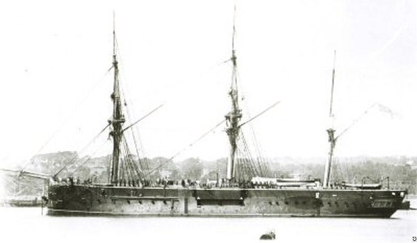
via Michael Montgomery (Castlereagh SAC)
All rights respectfully acknowledged
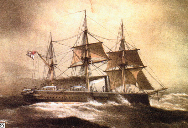
Sent in by email - source unknown
All rights respectfully acknowledged
Click
HERE
for INFOMAR* Side-Scan image |
| Source Publications: |
| "Dictionary
of Disasters at Sea during the Age of Steam 1824
- 1962" |
by | Charles Hocking |
| London Stamp Exchange 1989 - ISBN: 0948130474 | ||
|
"Irish
Wrecks Database" | by | Roy Stokes & Liam Dowling |
|
"Shipwreck
Index of Ireland" |
by | Richard & Bridget Larn |
| Lloyd's Register - Fairplay Ltd 2002 - ISBN: 1900839970 | ||
|
"Shipwrecks
of the Irish Coast 1105 – 1993" |
by | Dr. Edward J. Bourke |
| Edward J. Bourke 1994 - ISBN: 0952302705 |
| Other Sources: |
*source
- Geological Survey of Ireland | - | Internet (2020) |
| Marlin
SAC | - | Internet (1999) |
|
|
Last update - 18-Nov-2020
|
|
A page from "www.irishwrecksonline.net" ©