 |
 © ©
|  |
 |
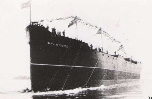
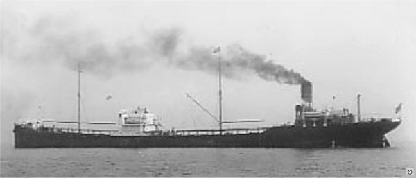
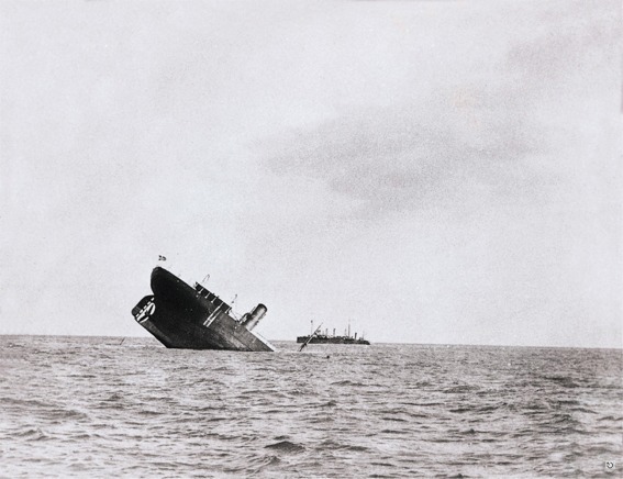
| Vessel Type: | Norwegian Tanker | Location: | Co. Cork |
| Date of Loss: | 22th March 1917 | Place: | Baltimore |
| Cause of Loss: | Torpedoed | Boat Dive from: | Baltimore |
| Charted Depth: | 65m | Irish O.S. Map: | Discovery Series No. 88 |
| Height of Wreck: | 7m | Admiralty Chart No: | 2184 |
| Hull Material: | Steel | Latitude (approx.): | 51° 26' 24" North* |
| Type of Seabed: | Rocks & kelp | Longitude (approx.): | 09° 22' 48" West* |
| Average Visibility: | 10 - 15m | Convert Lat. & Long. to - | Decimal - CLICK HERE |
| Image available? | Yes - see below | Diving Experience: | Very Experienced |
| Diving Information: |
|
| Historical Information: |
|
© by kind permission of wrecksite.eu web site
Jim Gray via email
All rights respectfulyl acknowledged
© by kind permission of Dr. Edward J. Bourke
Click
HERE
for INFOMAR* Side-Scan image |
Source
Publications: |
| "Dictionary of Disasters at Sea during
the Age of Steam 1824
- 1962" |
by | Charles Hocking |
| London Stamp Exchange 1989 - ISBN: 0948130474 | ||
| "Irish
Wrecks Database" | by | Roy Stokes & Liam Dowling |
|
"Shipwreck
Index of Ireland" |
by | Richard & Bridget Larn |
| Lloyd's Register - Fairplay Ltd 2002 - ISBN: 1900839970 | ||
|
"Shipwrecks
of the Irish Coast 1105 - 1993" |
by | Dr. Edward J. Bourke |
| Edward J. Bourke 1994 - ISBN: 0952302705 | ||
|
"Underwater
Ireland Guide to Irish Dive Sites" |
by | Irish Underwater Council |
| CFT 1999 - ISBN: 0948283025 |
Other
Sources: |
Aquaventures | - | Internet (2001) |
*source
- Geological Survey of Ireland | - | Internet (2020) |
| Mike
Morrish | - | Date of Loss correction via Email (2022) |
| |
Last update - 14-Sep-2022
|
|
A page from "www.irishwrecksonline.net" ©