 |
 © ©
|  |
 |
| Vessel Type: | Dutch Motor Coaster | Location: | Co. Antrim |
| Date of Loss: | 20th January 1942 | Place: | Belfast Lough |
| Cause of Loss: | Collision at sea | Boat Dive from: | Whitehead or Bangor |
| Charted Depth: | 43m | Irish O.S. Map: | Discovery Series No. 15 |
| Height of Wreck: | 9m | Admiralty Chart No: | 1753 |
| Hull Material: | Steel | Latitude (GPS): | 54° 42' 42.48" North |
| Type of Seabed: | Sand and silt | Longitude (GPS): | 05° 31' 48.66" West |
| Average Visibility: | 5 - 10m | Convert Lat. & Long. to - | Decimal - CLICK HERE |
| Image available? | Yes - see below | Diving Experience: | Very Experienced |
| Diving Information: |
|
| Historical Information: |
|
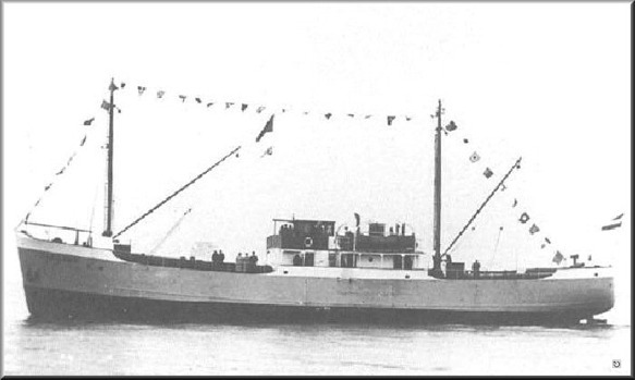
©
by kind permission of Willem
Vanvoorst
web site
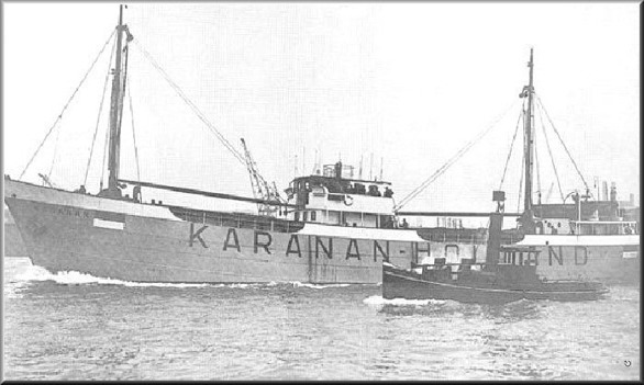
© by kind permission of Willem Vanvoorst web site
| Source Publications: |
| "Irish
Wrecks Database" | by | Roy Stokes & Liam Dowling |
|
"Shipwreck
Index of Ireland" |
by | Richard & Bridget Larn |
| Lloyd's Register - Fairplay Ltd 2002 - ISBN: 1900839970 | ||
|
"Underwater
Ireland Guide to Irish Dive Sites" |
by | Irish Underwater Council |
| CFT 1999 - ISBN: 0948283025 |
| Other Sources: |
| Bryan
Lawther | - | via Email (2012) |
| - | Willem Vanvoorst | |
| Peter
Steel | - | North Irish Lodge, Islandmagee (1998) |
| Vic
Foster | - | Castlereagh SAC (1996) |
| |
Last update - 16-Jun-2012
|
|
A page from "www.irishwrecksonline.net" ©