 |
 © ©
|  |
 |
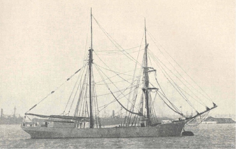
| Vessel Type: | Brigantine | Location: | Co. Down |
| Date of Loss: | 11th January 1924 | Place: | Tara Point |
| Cause of Loss: | Struck rocks | Boat Dive from: | Portaferry or Strangford |
| Charted Depth: | 10m | Irish O.S. Map: | Discovery Series No. 21 |
| Height of Wreck: | Scattered | Admiralty Chart No: | 2159 |
| Hull Material: | Steel | Latitude (approx.): | 54° 37' 33" North |
| Type of Seabed: | Longitude (approx.): | 05° 21' 55" West | |
| Average Visibility: | Convert Lat. & Long. to - | Decimal - CLICK HERE | |
| Image available? | Yes - see below | Diving Experience: | Experienced Novice |
| Diving Information: |
|
| Historical Information: |
|
Photographer unknown
All rights respectfully acknowledged
| Source Publications: |
| "Irish
Wrecks Database" | by | Roy Stokes & Liam Dowling |
|
"Q-Ships
and their story" |
by | E.K. Chatterton |
| Conway Maritime Press 1972 - ISBN: 85177055X | ||
| "Shipwrecks
of the Ulster Coast" |
by | Ian Wilson |
| Impact Printing 1997 - ISBN:0948154993 |
| |
Last update - 18-Jan-2005
|
|
A page from "www.irishwrecksonline.net" ©