 |
 © ©
|  |
 |
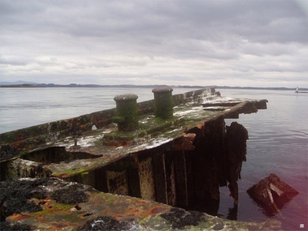
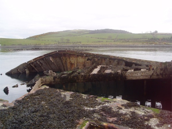
(Lee's Wreck)
| Vessel Type: | Liberty Ship | Location: | Co. Down |
| Date of Loss: | 1947/1948 | Place: | Ballyhenry Bay, Strangford Lough |
| Cause of Loss: | Ran aground | Boat Dive from: | Portaferry |
| Charted Depth: | Breaks surface | Irish O.S. Map: | Discovery Series No. 21 |
| Height of Wreck: | 15m | Admiralty Chart No: | 2156 |
| Hull Material: | Steel | Latitude (GPS): | 54° 23' 21.6" North |
| Type of Seabed: | Rocks and shale | Longitude (GPS): | 05° 34' 21" West |
| Average Visibility: | 10 - 15m | Convert Lat. & Long. to - | Decimal - CLICK HERE |
| Image available? | Yes - see below | Diving Experience: | Novice |
| Diving Information: |
|
| Historical Information: |
|
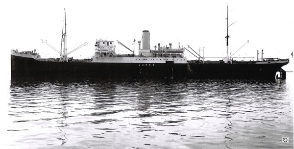
("S.S. Empire Tana" as the "S.S. Carso")
© by kind permission of Giorgio Spazzapan Collection
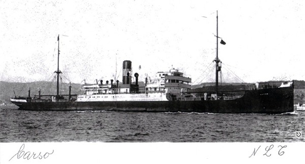
("S.S. Empire Tana" as the "S.S. Carso")
© by kind permission of Giorgio Spazzapan Collection
via email
All external rights respectfully acknowledged
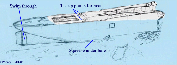
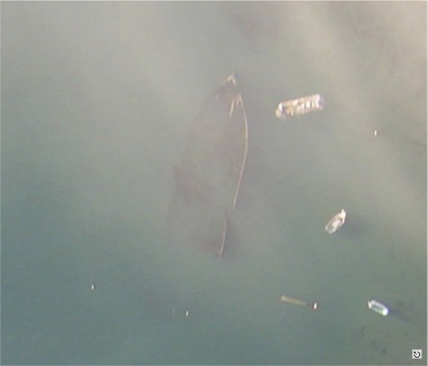
© Michael Montgomery, Castlereagh SAC, 2006
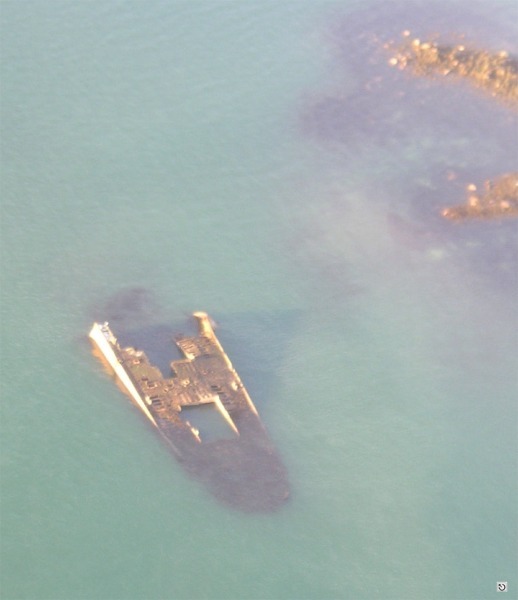
© Michael Montgomery & Nick Cooke, Castlereagh SAC, 2006
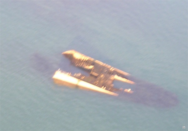
© Michael Montgomery & Nick Cooke, Castlereagh SAC, 2006
© Michael Montgomery & Nick Cooke, Castlereagh SAC, 2006
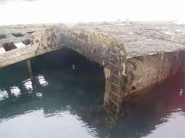
© Michael Hamilton, Castlereagh SAC, 2004
© Michael Hamilton, Castlereagh SAC, 2004
© Michael Hamilton, Castlereagh SAC, 2004
| Source Publications: |
| Down
Recorder article - 11/09/85 |
by | Dr. R. Brown |
| "Irish
Wrecks Database" | by | Roy Stokes & Liam Dowling |
|
"Shipwreck
Index of Ireland" |
by | Richard & Bridget Larn |
| Lloyd's Register - Fairplay Ltd 2002 - ISBN: 1900839970 | ||
|
"Shipwrecks
of the Irish Coast 932 – 1997" |
by | Dr. Edward J. Bourke |
| Edward J. Bourke 1998 - ISBN: 0952302713 | ||
| "Underwater
Ireland Guide to Irish Dive Sites" |
by | Irish Underwater Council |
| CFT 1999 - ISBN: 0948283025 |
| Other Sources: |
Randal
Armstrong | - | Castlereagh SAC (1977) |
| Michael
Montgomery | - | Castlereagh SAC (2005) |
|
|
Last update - 02-Feb-2006
|
|
A page from "www.irishwrecksonline.net" ©