 |
 © ©
|  |
 |
| Vessel Type: | Trawler | Location: | Co. Donegal |
| Date of Loss: | 23rd November 1976 | Place: | Rathlin O'Byrne |
| Cause of Loss: | Foundered | Boat Dive from: | Malinbeg |
| Charted Depth: | 36m | Irish O.S. Map: | Discovery Series No. 10 |
| Height of Wreck: | Scattered | Admiralty Chart No: | 1879 and/or 2852 |
| Hull Material: | Wood | Latitude (approx.): | 54° 39' 55" North |
| Type of Seabed: | Rocks & Boulders | Longitude (approx.): | 08° 50' 10" West |
| Average Visibility: | 15 - 20m | Convert Lat. & Long. to - | Decimal - CLICK HERE |
| Image available? | Yes - see below | Diving Experience: | Experienced |
| Diving Information: |
|
| Historical Information: |
|
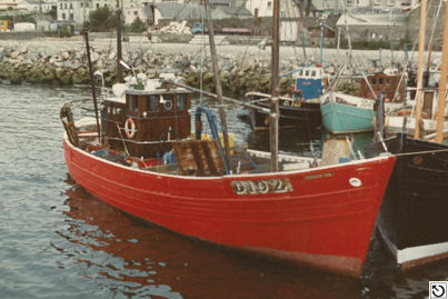
© by kind permission of Trawler Photos web site
| Source Publications: |
| "Donegal,
An Exploration" |
by | J.J. Tohill |
| Donegal Democrat Ltd 1976 | ||
|
"Donegal
Shipwrecks" |
by | Ian Wilson |
| Impact Printing 1998 - ISBN: 094815456X | ||
| "Shipwreck
Index of Ireland" |
by | Richard & Bridget Larn |
| Lloyd's Register - Fairplay Ltd 2002 - ISBN: 1900839970 | ||
| "Shipwrecks
of the Irish Coast 1105 - 1993" |
by | Dr. Edward J. Bourke |
| Edward J. Bourke 1994 - ISBN: 0952302705 |
| Other Sources: |
| - | via Email Apr 2009 | |
| Edward
Carbery | - | via Email May 2002 |
| Randal
Armstrong | - | Castlereagh SAC (1982) |
|
|
Last update - 08-Jul-2020
|
|
A page from "www.irishwrecksonline.net" ©